Downtown, late 1920s

Downtown, looking west toward Sam Houston Hall, late '20s. The Julia Ideson building can be seen left of center.
Labels: city life, photographs
posted by J.R.G. @ 1:02 AM
5 comments


Labels: city life, photographs
posted by J.R.G. @ 1:02 AM
5 comments

Labels: photographs, transportation
posted by J.R.G. @ 11:38 AM
2 comments

Labels: city life, photographs
posted by J.R.G. @ 10:43 AM
4 comments

This aerial photograph was taken sometime around April 1923. To the left is the Turning Basin. Somewhere down the center of the photograph is where Loop 610 would be today.
Labels: photographs
posted by J.R.G. @ 2:42 AM
5 comments


Two photos, circa 1923, of the Houston Ship Channel area. I have a few more I'll share over the next couple of weeks.
Labels: city life, photographs
posted by J.R.G. @ 1:36 AM
4 comments

Labels: city life, photographs
posted by J.R.G. @ 12:55 AM
1 comments
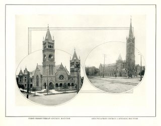
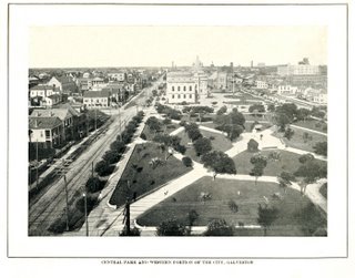
Labels: churches, Galveston, photographs
posted by J.R.G. @ 2:41 AM
3 comments

Labels: Main Street, photographs, weather
posted by J.R.G. @ 7:27 PM
2 comments
 The Horne Sanatorium -- located in the Heights -- was named after Dr. J. Alvin Horne. It didn't last long under his management. The building, which later became the Texas Christian Sanitarium, apparently burned in 1915, according to this Web site.
Labels: photographs
posted by J.R.G. @ 11:24 AM
0 comments
 Texas Avenue looking west at Fannin Street, 1907. Note the Rice Hotel on the far left and the original Chronicle building between the two buildings in the foreground.
 And for the Galveston folks...Market Street, 1907.
Labels: photographs
posted by J.R.G. @ 12:22 PM
0 comments
 Main Street and Lamar Avenue, 1941. You don't have to look very hard to find similar photos of this theater district. In addition to the Loew's State and Metropolitan on the left, the Kirby is on the right. The neon sign on the far right belongs to a "feminine apparel" store. This picture was apparently taken before Woolworth's opened at McKinney Avenue and Main Street.
 Travis Street and Capitol Avenue, 1913. Contrary to the note on the photograph, I think the photographer was looking north or northeast rather than east. Anyway, this picture was taken just before renovations began on the old Rice Hotel. Farther up Travis, we see the Southern Pacific Building under construction along with the Union National Bank Building just right of center.
Labels: photographs
posted by J.R.G. @ 12:44 AM
3 comments
 Milam Street and Congress Avenue
 Milam Street, between Commerce and Franklin. Last time I checked, that building was still there and looks pretty much the same from behind. The front has changed somewhat, I think. That's Bayou Lofts (the old Southern Pacific building) in the background.
 This is the northeast corner of what's now Jones Plaza!
 This is Louisiana Avenue, looking north toward Texas Avenue. The old city auditorium (now Jones Hall) is on the right.
Labels: disasters, photographs
posted by J.R.G. @ 3:31 AM
6 comments


Labels: disasters, photographs
posted by J.R.G. @ 3:56 PM
1 comments

This is the intersection of Louisiana Street and Texas Avenue, looking west. To the left is the old City Auditorium. On the right is the Auditorium Hotel, which is now the Lancaster Hotel.
This picture was taken in December 1935 after rains drenched much of downtown Houston and the Houston Ship Channel.
According to the Harris County Flood Control District, damage from the 1935 flood totaled nearly $3 million ($41,414,787.72 in today's dollars) and killed seven people. Twenty-five blocks of downtown Houston were submerged along with 100 residential blocks.
Floods like this one led to the creation of the Addicks and Barker reservoirs located in far west Houston.
More about the Harris County Flood Control District can be found here.
I have a few more photos from the flood, and I'll post them soon.
Labels: photographs
posted by J.R.G. @ 5:33 AM
3 comments


Copyright 2007, J.R. Gonzales.


